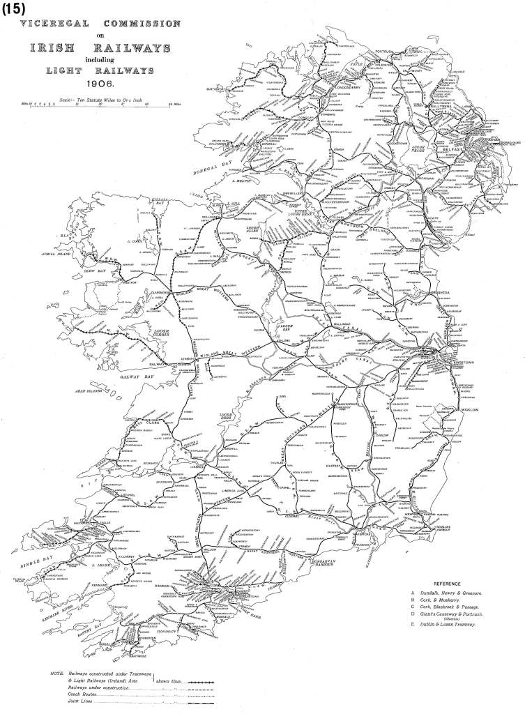
The above should be of profound interest to anyone who’s looking for solutions to the climate crisis. If they could do it in 1906, we can do it now.
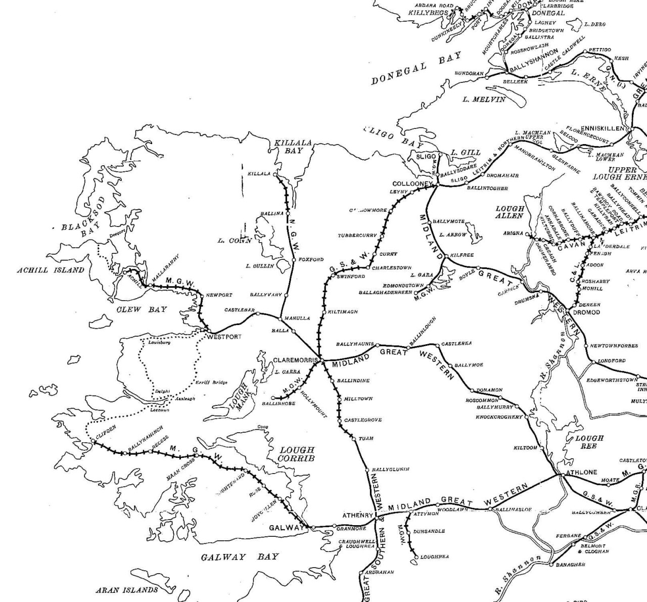
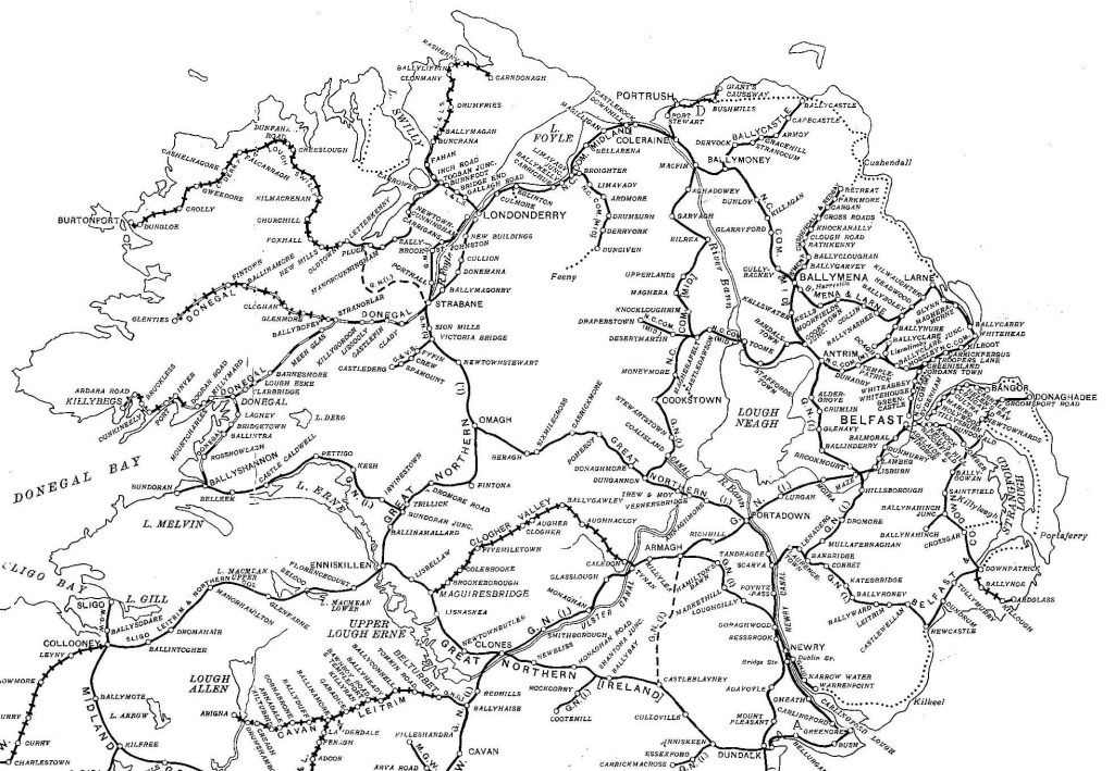
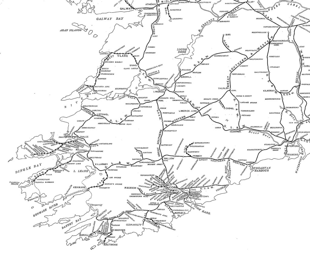
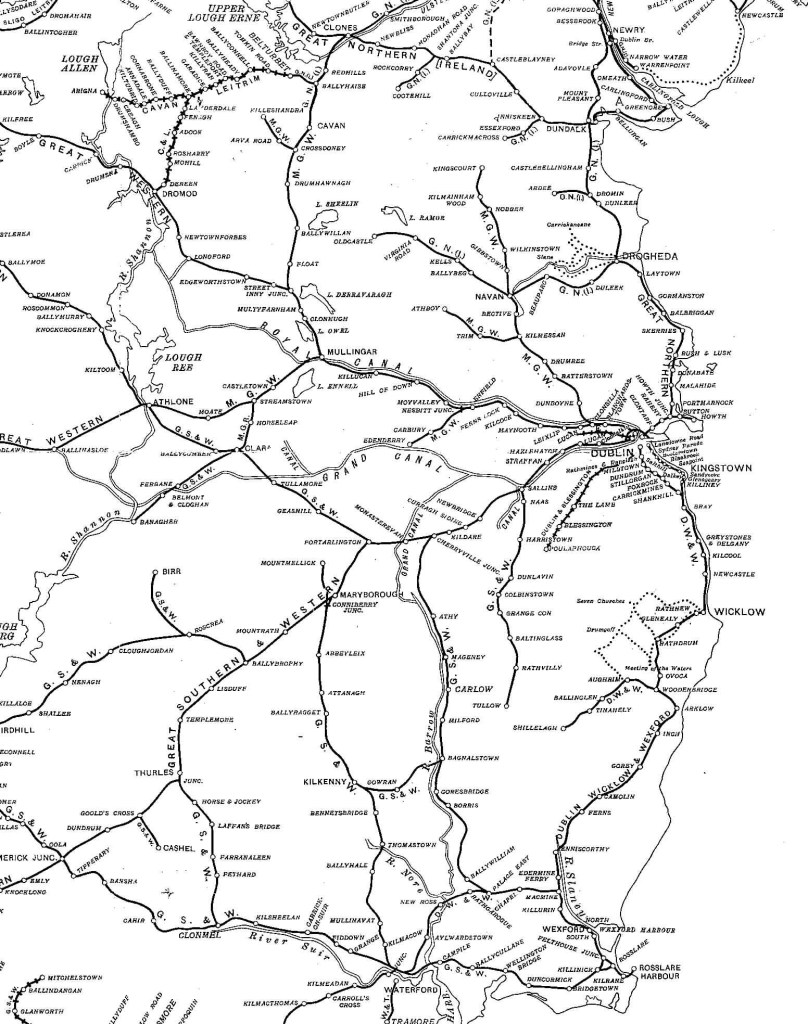
Below are zoomed-in versions on each of the four provinces. But first, a map of today’s rail network for comparison. The comparison is not entirely fair as DART and Luas don’t feature on it. Even allowing for that, the contrast is striking.
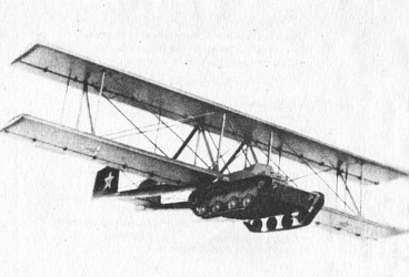
The striking image above shows a glider-borne tank, tested unsuccessfully by the Soviet Union in the 1940s. The genesis of this idea was even stranger, like something out of a Command and Conquer game:
‘Tuchachevsky likewise paid particular attention to the Air Force. For some years he had studied the problem of combining the functions of aeroplane and tank in a machine to be known as the ‘flying tank,’ i.e., an armoured car which automatically or by a few turns of a handle could be transformed into an aeroplane and then changed back again into a tank that was ready to go into action as soon as it landed. There is also a compromise solution of this problem in the form of large-sized aircraft which can transport a tank by air and land it behind the enemy’s lines.
‘The study of the ‘flying tank’ led to successful experiments in the large-scale employment of special shock troops that could be dropped behind the enemy’s lines by parachute. It is no mere chance that this idea of aerial infantry originated in the brain of Tuchachevsky, the Commander-in-Chief of the first Red Army of workers and peasants.
‘The idea of dropping such detachments in the enemy’s rear presupposes that this area is peopled by inhabitants in sympathy with the aerial invaders, for otherwise such aerial shock troops as survived the attentions of the enemy’s anti-aircraft batteries would be wiped out by mechanized units hastily despatched to deal with them. The conception of a parachute corps is therefore closely connected with the idea of an international Socialist Revolution.’
From Erich Wollenberg’s book The Red Army – which is great as well as free to read online.
The genius of Tukhachevsky was such that even when he was preoccupied with a bizarre idea, like a plane that could turn into a tank, he ended up stumbling on a great idea – parachute soldiers. It’s also fascinating that the original inspiration for the idea of paratroopers was Tukhachevsky trying to figure out ways to help socialist revolutions in hostile countries.
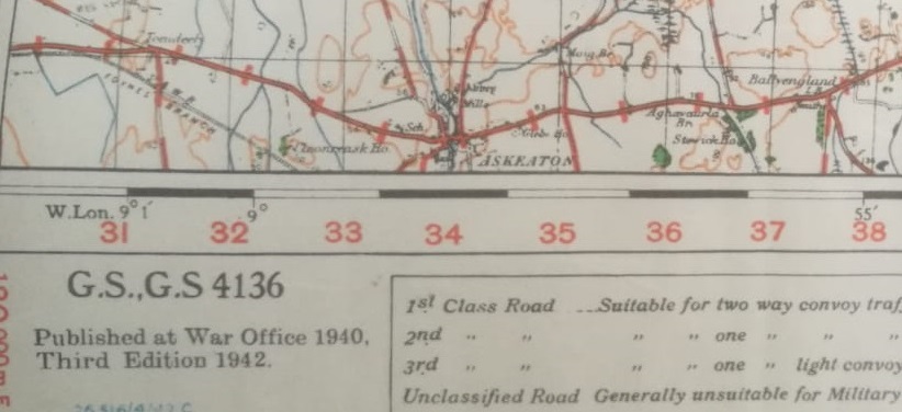
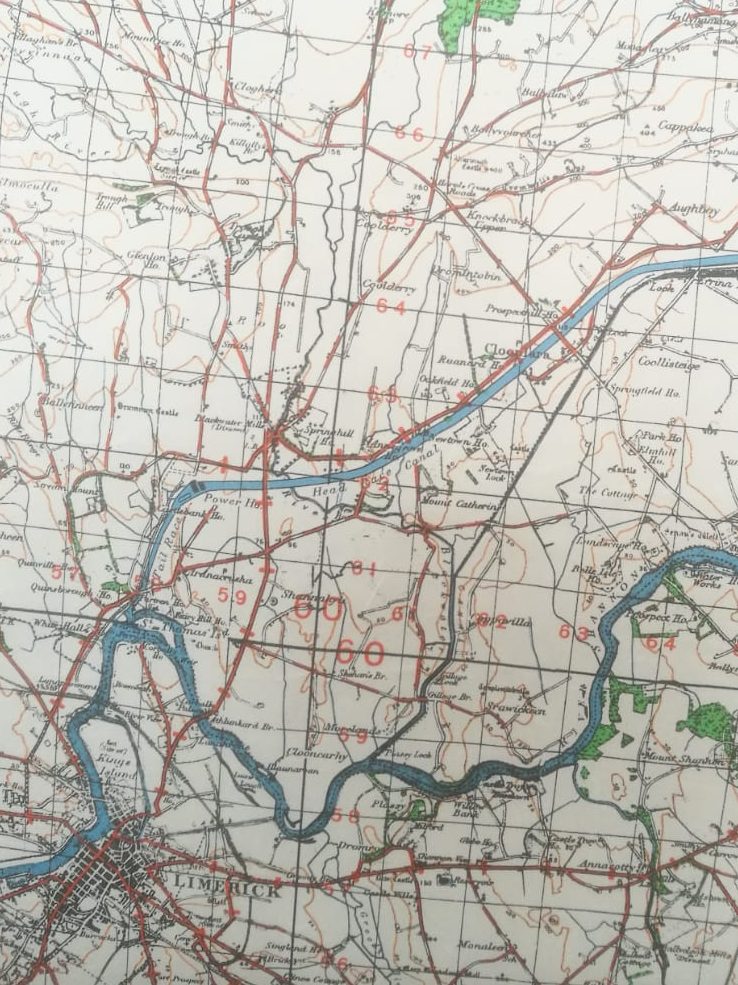
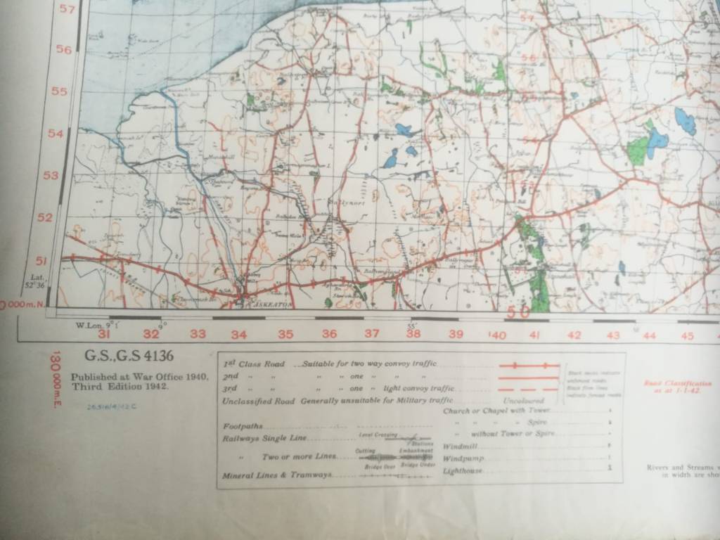
During World War Two the British War Office produced a series of incredibly detailed maps of Ireland. These were to serve British forces in the event that they were to invade the former colony that had sent them packing twenty years earlier.
The British army donated these maps to the Irish defence forces long after the war. But most were destroyed in a fire in Kildare Barracks, some time in the early 2000s.
These maps cover the entire island and show every field and city block. The Irish army themselves did not possess such detailed maps. Such are the perks of being able to dispose of the revenues of a world-spanning empire. See the military details noted in the second image, below.
Of course, Britain had been in control of all Ireland until 1921. They would have possessed maps that were twenty years out of date. But the first image above includes the Shannon hydroelectric dam, which was built years after independence.
How, then, were these maps drawn up? My guess is, on the basis of old British army maps, updated with details supplied by spies on the ground or aerial photography.
In a few weeks I’ll be in a position to upload some better-quality images, so keep an eye out.


